G-WADI-Associated Product found to be Overall Best for Detecting Precipitation Extremes over Mainland China

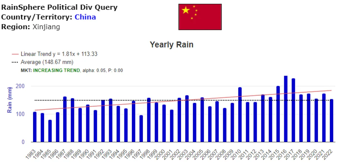
Based on PERSIANN -CDR data for western China. (Source: https://rainsphere.eng.uci.edu)
Satellite-based quantitative precipitation estimates (QPEs) have shown great potential for monitoring precipitation (P) at large spatial scales. Most important is their ability to forecast hydrologic extremes--i.e., floods and droughts.
A recent article in Atmospheric Research (Zhang et al., 2022; https://www.sciencedirect.com/science/article/abs/pii/S0169809522003738) evaluated four satellite precipitation products, including PERSIANN CDR--a system developed and maintained with the cooperation of UNESCO G-WADI. for estimating precipitation extremes over mainland China at annual, seasonal and monthly scales. They used various assessment metrics, such as maximum 1-day P, the simple daily intensity index (SDII), the count of days with P ≥ 20 mm, and the consecutive dry days (CDD).
Results indicate that PERSIANN-CDR performed overall best for the four indices at all timescales. For example, PERSIANN-CDR outperformed the other products in summer and autumn and along with one other product outperformed the others in winter as well.
More information on PERSIANN-CDR can be found at https://chrs.web.uci.edu/ .
