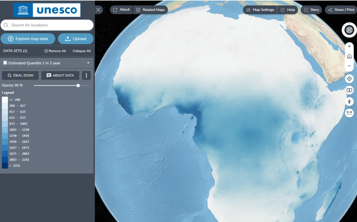
African Drought Atlas Completed and Loaded into IHP-WINS

African Drought Atlas
CAZALAC and IHP-WINS
The African Drought Atlas (ADA) is aimed at developing a comprehensive understanding of hydro-climatic extreme events in the Africa region. It is designed to assist drought planners and decision-makers in both public and private sectors.
The ADA is inspired by the successful Drought Atlas for Latin America and Caribbean released by UNESCO-IHP and the Water Center for Arid and Semi-Arid Zones in Latin America and the Caribbean (CAZALAC). During an African regional workshop on “Climate Change Risk, Vulnerability Assessment and Early Warning for Africa” in 2017, the need had been identified to develop a similar atlas of hydro-climatic extreme events in the Africa region.
The "African Drought Atlas" project has developed a series of quantile and return period maps representing the expected minimum and maximum precipitation across various return periods, as well as precipitation deficits and surpluses in African countries. The use of a statistical method called Regional Frequency Analysis using L-Moments (ARF-LM) methodology has yielded robust and high-resolution results, providing a valuable tool for water resource planning and management in the region. These maps not only facilitate the identification of areas vulnerable to drought but also serve as a foundation for developing mitigation and adaptation policies in the context of climate change.
The ADA has now been loaded into the Intergovernmental Hydrological Programme's Water Information Network System (IHP-WINS). IHP-WINS is designed to promote the sharing and dissemination of water-related data and information among countries, organizations, and stakeholders involved in water resources management, as part of the UNESCO IHP mandate. The location is:
https://ihp-wins.unesco.org/dataset/african-drought-atlas.
