Image Eighth Meeting of Asian G-WADI Network Held Together With 2nd International Drought Initiative Expert Group Meeting Jan. 2, 2019 The 8th Asian G-WADI and 2nd International Drought Initiative (IDI) expert group meetings were held in Khorasan Razavi Province (Holy City of Mashhad), Iran on 10-12 December 2018. These events were hosted by Khorasan Razavi Regional Water Authority in close cooperation with the Regional Centre on Urban Water Management (RCUWM), under the auspices of UNESCO. The event received the support of UNESCO's International Hydrological Programme, UNESCO Field Offices in Tehran, Jakarta and New Delhi, the Ministry of Energy of I.R Iran, Iran Water Resources Management Company and the University of Ferdowsi, Mashhad. Read more
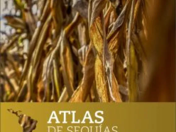
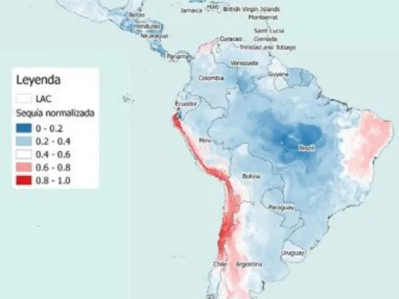
Image Inaugural African Drought Atlas Training Course Held Nov. 17, 2018 In October 2018, after over a decade of effort, a Drought Atlas for Latin America and Caribbean was released by UNESCO-IHP and the Water Center for Arid and Semi-Arid Zones in Latin America and the Caribbean (CAZALAC). The Atlas uses Regional Frequency Analysis (RFA), based on a statistical method called L-moments, to assist drought planners and decision-makers in both public and private sectors. Read more
Image Drought Atlas for Latin America and the Caribbean Released by UNESCO and CAZALAC Oct. 29, 2018 UNESCO and the Water Center for Arid and Semi-Arid Zones in Latin America and the Caribbean (CAZALAC) have released the Atlas de Sequías de América Latina y el Caribe, or Drought Atlas for Latin America and the Caribbean. Read more
Image International G-WADI Seminar on "Citizen Science for Water Management and Drought", Santiago, Chile Oct. 11, 2018 The participation of the general public in the collection and interpretation of information for research and decision-making is often referred to as citizen science. While citizen science itself has existed since the beginning of scientific practice, advances in technology detection, data processing and visualization, and communication of ideas and results are creating a wide range of new opportunities for public participation in scientific research. Read more
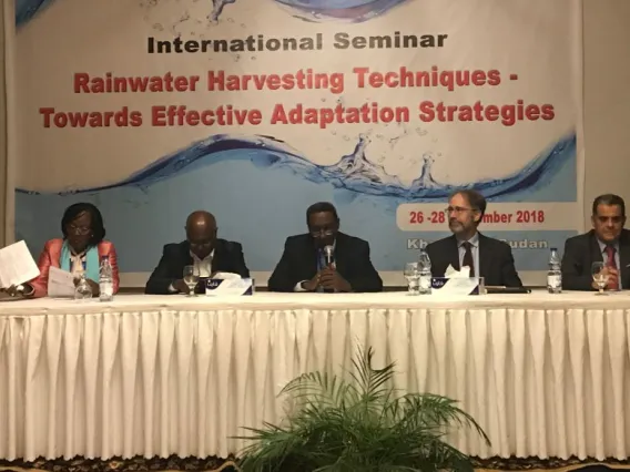
Image G-WADI Co-Sponsors Rainwater Harvesting Seminar at Regional Centre for Capacity Development and Research in Water Harvesting Sept. 29, 2018 One of the techniques for drylands water management identified in the earliest years of the G-WADI network was for the collection and management of flood- or rainwaters to increase water availability for domestic, agricultural or ecosystem use. This approach, called “water harvesting”, has been a traditional means of storing water in the Indian Subcontinent, the Middle East, North and East Africa, and the Americas for millennia. G-WADI Workshops on the topic have been held on three continents, beginning in 2005. Read more
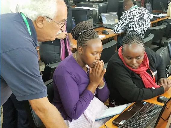
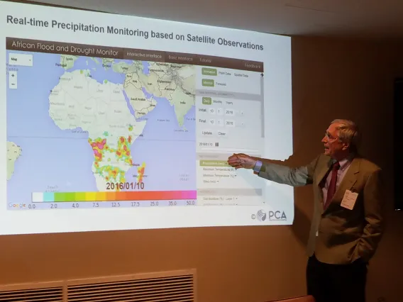
Image UNESCO and Makerere University Bring G-WADI Precipitation Tools to East Africa Aug. 10, 2018 In arid East Africa, water is an increasingly scarce commodity. Governments in the region need better tools to manage this water, beginning with accurate estimates of rainfall in both real time and historically. The University of California, Irvine’s Center for Hydrometeorology & Remote Sensing (CHRS) has created satellite precipitation data and information systems that are useful for both purposes. G-WADI and its technical secretariat, ICIWaRM, have supported development of these tools for almost a decade. Read more
Image G-WADI Flood and Drought Products Discussed at Side Event on "Hydrology Towards Sustainable Resilient Societies at United Nations" July 13, 2018 As part of the UN High-Level Political Forum on Sustainable Development, UNESCO-IHP, World Meteorological Organization, the International Center for Integrated Water Resources Management (ICIWaRM) and the International Centre for Water Hazard and Risk Management (ICHARM) organized a side event on Hydrology towards Sustainable Resilient Societies. The event took place on July 10, 2018 at the United Nations headquarters in New York. Read more
G-WADI Products Featured at GEWEX Meetings on Water Extreme Events May 15, 2018 The G-WADI Program was featured in several talks at the 8TH GEWEX Open Science Conference: Extremes and Water on the Edge, May 6 - 11, 2018 in Canmore, Alberta, Canada. A presentation by UNESCO IHP staff, titled "Climate-informed Decision Making under Deep Uncertainty," highlighted products developed by G-WADI and its partners, such as Latin American and Caribbean Drought Monitor, the African Flood and Drought Monitor, the PERSIANN family of products, the Latin American and Caribbean Drought Atlas, and their applications. Read more
G-WADI Participates in UNESCO's Regional Workshop on Climate Services for Improved Water Resources Management, Harare, Zimbabwe March 2, 2018 The G-WADI Technical Secretariat and IHP staff participated in the Regional workshop on climate services for improved water resources management in Harare, Zimbabwe, from 30 Jan - 1 Feb 2018. The workshop was attended by high level experts from SADC countries with support from UNESCO's Regional Office for Southern Africa, UNESCO's International Hydrological Programme (IHP), the Zambezi Watercourse Commission (ZAMCOM) and the Government of Flanders. G-WADI tools such as the African Flood and Drought Monitor were discussed for their potential applications to hydrologic extreme events in the region. More information on the meeting is available from UNESCO's Harare office. Read more
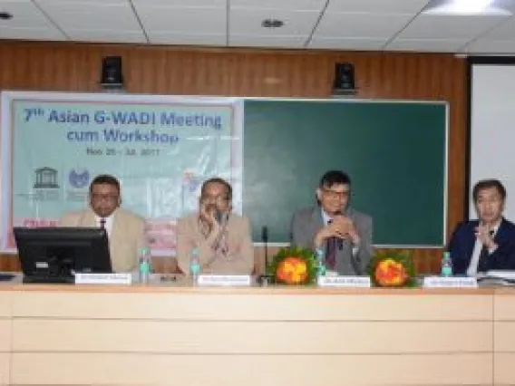
Image Asian G-WADI Holds 7th Meeting and Workshop in Hyderabad, India Jan. 15, 2018 The Asian regional network of G-WADI held its 7th meeting and workshop at the National Geophysical Research Institute (NGRI), Hyderabad, India from Nov. 26-30, 2017. The major scientific topic of discussion at the workshop was an increased inclusion into G-WADI of research on semi-arid region groundwater systems. Use of airborne geophysical investigations to obtain a 3-D continuous picture of the subsurface, as well as the potential impacts of climate change, such as highly variable rainfall, increase in temperature, sea level rise etc., on groundwater fluxes were discussed. Read more