G-WADI-Developed Real-time Precipitation Dataset Incorporated into Newest Version of NASA's IMERG
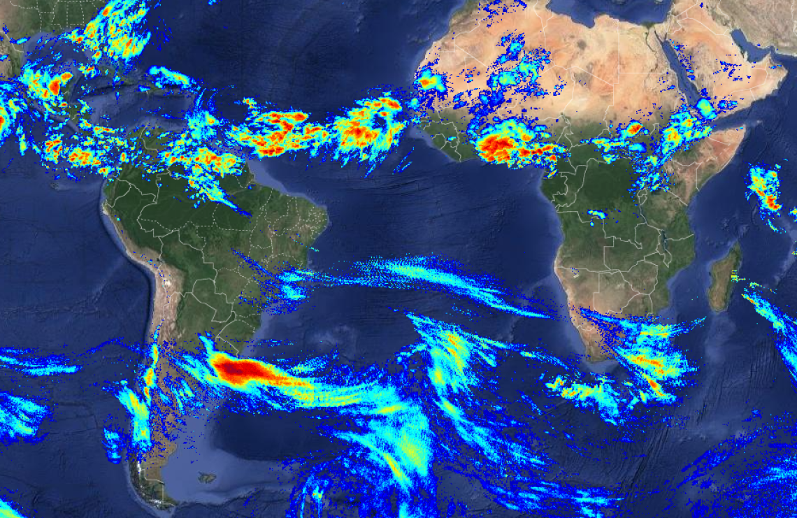
PDIR-iRain image from 17 Aug 2023
UC-Irvine CHRS - https://irain.eng.uci.edu/
The near-real-time, G-WADI affiliated precipitation dataset developed by the Center for Hydrometeorology and Remote Sensing (CHRS) of the University of California, Irvine, has been incorporated into NASA's IMERG products. (IMERG, the Integrated Multi-satellitE Retrievals for Global Precipitation Management Mission, is a unified satellite precipitation product produced by NASA to estimate surface precipitation over most of the globe.)
Developed and maintained with partial support from UNESCO, the International Center for Integrated Water Resources Management (ICIWaRM) and others, the PERSIANN Dynamic Infrared Rain Rate (PDIR-Now) dataset provides hourly, quasi-global, infrared-based precipitation estimates at 0.04° × 0.04° spatial resolution with extremely short latency (15–60 min). It is part of the PERSIANN family of precipitation products, and is documented in the Journal of Meteorology.
The high resolution of the product and its short latency have made it ideal for incorporation into the newest version (V07) of NASA IMERG, especially its "early run" product. While this product can improve the accuracy of the the precipitation estimates by combining PDIR-Now with other data sources, it increases the latency to about four hours. Thus, in the case of flash flooding the raw PDIR-Now product can provide important early data.
PDIR-Now has also been incorporated into the iRain interface (https://irain.eng.uci.edu/), a website that provides a user-friendly interface to visualize global precipitation dataset for the last 3-72 hours, and can be downloaded from the CHRS Data Portal (https://chrsdata.eng.uci.edu/), which is an interface for the download of PDIR-Now dataset as well as other PERSIANN family datasets.